The southern edge of WA is a striking stretch of largely undeveloped and often rugged coastline bordered by towering old-growth jarrah and karri forests. Known as the Great Southern, the area includes the scenic Stirling Ranges, wineries and the historic town of Albany, the oldest European settlement in WA. Further east, the beautiful turquoise coastline continues to Esperance and Cape Arid at the western end of the Great Australian Bight.
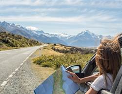
How long? Allow a week, one way.
When to go: Summer is normally dry and warm, although tempered by sea breezes. Almost all the region’s rain falls during the winter months, but winter is the best time to see whales. For wildflowers, visit in spring: the peak flowering time is Aug to Nov.
Need to know: Fallen trees may sometimes block roads in the national parks of the South West, so allow plenty of time for drives in case you find yourself needing to backtrack.
Drive rating: Easy. Mostly sealed roads with optional 4WD sections.
Acknowledgement of Country: This is the Traditional Land of the Bibbulman, Menang, Goreng, Ngatjumay and Wudjari Peoples.
Distance planner
- Augusta to Cape Arid National Park: around 955km
- Augusta to Albany: 364km
- Albany to Esperance: 474km
- Esperance to Cape Arid National Park: 156km
- Esperance to Perth (direct): 715km
AUGUSTA TO ALBANY

Head east from Augusta, not far from where two of the world’s greatest oceans converge to Pemberton. This is big-tree country, and the state’s most famous tree, the Gloucester Tree, is 3km from Pemberton in Gloucester National Park on the Traditional Land of the Bibbulman People. This 61m-high giant karri made a great lookout to help spot forest fires in the 1930s and 40s. Back then you had to get to the top the hard way, using special boots and a belt, but these days there’s a spiral of iron spikes embedded in the trunk. Be warned though: it’s harder (and scarier) than it looks, and less than a quarter of all those who try to climb the tree make it to the top.
There’s an even bigger giant in Warren National Park, also the Traditional Land of the Bibbulman People, around a 15min drive south-west of Pemberton. The Dave Evans Bicentennial Tree, another colossal karri, is a whopping 75m high, and you can climb that one too, if you’re game.
Both trees are part of the Karri Forest Explorer Drive, an 86km loop drive from Pemberton. It’s largely unsealed, and there are some steep sections, like the descriptively named Heartbreak Trail (not suitable for caravans or motorhomes), a one-way side-trip loop above and beside the Warren River.

Follow the South Western Hwy to Walpole and the Valley of the Giants, a forest of towering karri and tingle trees in Walpole–Nornalup National Park, on the Traditional Land of the Menang People. Some of the trees, particularly the red tingle, are as high as 75m, with a base circumference of 20m. The best way to really get to grips with just how big these majestic trees are is on the Tree Top Walk, which leads you along a 600m steel-truss treetop walkway up and over a deep red tingle gully. Below, a boardwalk winds through a grove of tingle trees known as the Ancient Empire, some of which are 400 years old. Some of the buttressed trees are split or hollowed out at the base, forming huge woody arches and tunnels that you can walk through.
From the Valley of the Giants it will take around 90min to drive to Albany, but chances are you’ll get sidetracked by one of the numerous roads that lead to the sea along the way. The beaches of WA’s southern coast are truly spectacular, with dazzling white sand so fine it squeaks.
A good spot to base yourself for a day or two en route is the charming township of Denmark beside the Denmark River on the shores of Wilson Inlet. It has a higher-than-average proportion of artists and alternative lifestylers, which gives it a relaxed – some may call it hippy – vibe. Denmark is also perfectly positioned to explore the scenic backroads that wind through vine-clad valleys and fabulous forests of tingle and karri. There’s also plenty of walking options along coastal trails – don’t miss Greens Pool and Elephant Cove in nearby William Bay National Park, both are magical spots to swim in summer, and Ocean Beach at the mouth of Wilson Inlet, where several tracks lead off to sensational lookouts.
Albany is a pretty town on King George Sound with a fascinating history. Established in 1827 as a far-flung military outpost of NSW by a party of 21 soldiers and 23 convicts who arrived on the Amity, it is the oldest town in WA. It was also the last place to stop commercial whaling on mainland Australia and when operations ceased at the whaling station in November 1978 the doors were simply locked with all the equipment left in situ, producing a unique time capsule and the only complete whaling station in the world that is open to visitors. Join a guided tour of the Historic Whaling Station to learn about the history of whaling and conservation, and climb aboard the last whalechaser boat in Australia. Albany was also the final departure point for the first ANZAC troops on their way to the battlefields of World War I and the National ANZAC Centre is both a moving memorial and fascinating museum that retells the story of the ANZACs and the conflict they fought in.

ALBANY TO ESPERANCE
Follow the South Coast Hwy – Highway 1 – from Albany east towards Esperance. It’s about a 5hr drive but will take a lot longer with the many scenic stops and detours: last time we drove this section it took us several days.
Take a 60km detour off the South Coast Hwy to Bremer Bay. This little seaside town is a gem of a place that developers seem to have overlooked. Heaven knows why, as it’s surrounded by stunning beaches with rolling surf, great expanses of sand dunes and views that stretch forever. But I won’t tell if you won’t. If you’re here in summer – Jan and Feb – you’ll be treated to one of nature’s most thrilling spectacles: a killer whale feeding frenzy. Every year hundreds of orcas (killer whales) congregate in the deep waters of the submarine Bremer Canyon around a 1hr boat ride from Bremer Bay to hunt and feast, mostly on giant squid. There are several tours available: try Whale Watch Western Australia or Naturaliste Charters.
You can either backtrack from Bremer Bay to link up with the highway again, or meander your way east on unsealed local roads to Point Ann in Fitzgerald River National Park. Every year, thousands of whales – humpbacks, southern rights and even the rare and endangered blue whale – journey along the South West coast on their way to and from the warm breeding grounds of the Kimberley coast and the Antarctic, often sheltering in the bays to rest, and the calm waters of the bay at Point Ann are just one of two places in Australia, where southern right whales come to calve in large numbers. There are two whale watching platforms on the headlands. The best time to see whales is during the winter months through to early spring – May to Sept – and the best time of day is usually around midday.
Fitzgerald River National Park is one of the most diverse botanical regions in the world. More than 1,800 beautiful and bizarre species of flowering plants thrive here, nearly 20% of the state’s plant species. You can’t miss the brightly coloured royal hakea that towers above the surrounding plains or the pretty qualup bell, which is not found anywhere else. Other highlights of this large tract of coastal wilderness include deserted beaches with 4WD access, inland lakes and rivers, and cliffs full of sea-sponge fossils.

Head out to Cape Le Grand National Park. The park is around 50km south-east of Esperance by sealed roads, to see whether Lucky Bay really is the whitest beach in Australia – similar claims are made for Whitehaven Beach in Queensland’s Whitsundays and Hyams Beach in Jervis Bay in NSW, but the locals here are quick to remind you that it’s been ‘scientifically proven’ by the National Committee on Soil and Terrain. Best way to settle the argument is to see it for yourself, but don’t forget your sunglasses, because it is definitely dazzling. There are some excellent bay-to-bay walking trails along the cliff-tops, where sea eagles soar above carpets of brightly coloured banksias and other wildflowers that are in full bloom during late winter and early spring.
Personally, I think the scientists that made the call about Lucky Bay should check out Cape Arid National Park, on the Traditional Land of the Ngatjumay and Wudjari Peoples, around 75km to the east. Sand can’t possibly come any whiter than this – the water really couldn’t be much bluer either – especially on the Tagon Coastal Trail, a gorgeous 4hr beach-to-beach-to-beach walk that starts near the Thomas River campground.
There used to be a track that led northward through the park from the coast past Israelite Bay and Mount Ragged to link up with Highway 1 near Balladonia at the western end of the Nullarbor, but it too has been closed to through traffic for a couple of years, so the only option is to head back to Esperance. From there you can head north for 200km or so to Norseman and hook up with the Eyre Hwy, which runs east across the Nullarbor, or continue north to pick up the Great Eastern Hwy and circle back to Perth.

This is an edited extract from Ultimate Coastal Road Trips: Australia by Lee Atkinson. Published by Hardie Grant Explore. Photographs by Lee Atkinson and others.